Home > Archive > Blair’s Bridges > The Blair Crossing
The Blair Crossing
BY Lou Schmitz (reprinted with permission of the author)
Chicago & North Western Historical Society Magazine – Fall 1997 Issue
With the Cedar Rapids & Missouri River Railroad (under lease to the C&NW) completed down the Boyer River to Missouri Valley and south to Council Bluffs on January 17, 1867-well ahead of its competitors thanks to the financing and direction of John I. Blair-it was time to pursue other opportunities. The Sioux City connection to the Pacific Railroad decreed by Congress in the initial Pacific Railroad Act of 1862 had never been constructed and presented a shining opportunity for John Blair to expand his empire westward with all the land grants and benefits of the initial Act.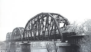
The Sioux City & Pacific Railroad Co. was actually organized at Dubuque, Iowa, on August 1, 1864 with John I. Blair as its first President to build this connection. It was August of 1867 however before the first 02 miles of track from Missouri Valley Junction to California Junction were completed by the Cedar Rapids & Missouri River Railroad. Here the Sioux City & Pacific took over to construct the track north to reach Sioux City in February 1868. The track west from California Junction to the Missouri River and from the river to Fremont, Nebraska (where it connected with the Union Pacific) was completed in early 1869. Car ferries were used to transfer cars and equipment across the Missouri River west of California Junction during the navigation season and temporary pile trestles were constructed over the river during the low water winter season when the ferries couldn’t operate. These “ice bridges” would soon disappear with the rising water and ice flows of early spring though. Location of the ferry ramps changed as the river flow and channel fluctuated and moved.
A wye track was in use on the east side of the river so engines could be turned for return to Missouri Valley after delivering or picking up their train at the ferry. Engines on the west side were operated from Blair, Nebraska, the closest community to the river crossing, located on the bluff some two miles west of the river. The town was platted in 1869 on land owned by John I. Blair and was given his name, which in turn became the name of the river crossing. Blair became the county seat of Washington County and by the end of 1870 hosted the track and trains of the Omaha & North Western (later the CStPM&O) that crossed the SC&P at that location on its way north.
General Plan
Missouri River Bridge
The original Missouri River bridge east of Blair, Nebraska with its three Whipple main trusses as it appeared from the west bank on the river about 1905.
To the displeasure of the Union Pacific, the daily SC&P passenger train from the C&NW connection at Missouri Valley to the UP connection at Fremont competed with the transfer of passengers at Council Bluffs and Omaha. An SC&P note in the 1870 Official Guide states that the train connects “at Fremont with all passenger trains on the Union Pacific Railroad for all points west. Passengers save 40 miles travel, two hours time, $2 fare and avoid transfer across the Missouri River at Omaha. There is no change of cars on this route, cars being ferried across the river on steamers.” The Missouri River bridge at Omaha was not completed until March 1872, requiring passengers to detrain at the ferry landing on the Iowa side with their baggage for the trip across the river and board a Union Pacific train on the Nebraska side to continue their trip west. Even with the Omaha bridge in place, the Iowa railroads, including the C&NW, refused to cross it due to bridge fees and to appease the City fathers of Council Bluffs. On the other side, the Union Pacific was forbidden to enter Iowa by a land agreement with the City of Omaha. A separate transfer railroad was set up to handle operations over the bridge until a Supreme Court order of October 1875 forced the UP to operate to Council Bluffs for the direct transfer of freight and passengers with the Iowa railroads. This reduced the advantages of the SC&P’s Blair crossing and it was no longer advertised as such.
Shortly after the original bridge across the Missouri River at Blair was completed in 1993, this photograph was taken from the Nebraska end of the bridge. The vulnerability of the low lying shore on the Iowa side to flooding is in evident; the riverbank in the distance behind the courageous employee was reinforced by facing the bank with large amount of heavy rock. Photo from the collection of Robert Franke.
On November 17, 1881, Mr. George S. Morison, a bridge engineer, was requested to meet with Mr. Horace Williams and others of the Sioux City & Pacific RR. Executive committee concerning a bridge over the Missouri River to connect the Iowa and Nebraska portions of that railroad. An inspection of the river in the Blair ferry area with SC&P Chief Engineer J.E. Ainsworth was made that same day. The rather wide flood plain, with a hard to control river channel in the Blair area, indicated a poor location for a bridge and an alternative site at Decatur, some 33 miles north, was suggested. The Decatur site was inspected the next day. Soil borings were made at both locations with a good rock foundation found at the Blair crossing and rather poor conditions at Decatur. The Blair location was selected and on July 25, 1882, a separate Missouri Valley & Blair Railway and Bridge Company was formed for financing and construction with Mr. George Morison as Chief Engineer and Horace Williams as President during construction.
The Missouri Valley & Blair Railway and Bridge Company was One of four such proprietary bridge companies controlled by C&NW. In the case of the Blair Bridge, the bridge company had been formed to construct the line and ultimately to build the bridge because the Sioux City & Pacific Railroad, of which it was the natural extension, lacked the cash to do it. The necessary funds were raised by the sale of stock to the interested neighboring companies, the Cedar Rapids & Missouri River, and the Chicago Iowa & Nebraska, the SC&P, and the C&NW, each in proportion to its mileage from Chicago to Fremont. When the C&NW bought the other railroad companies in 1884, it also acquired their shares of the bridge company stock. The bridge company continued in existence until 1934 when it was incorporated into the C&N W.
An Act of Congress on June 27, 1882 authorized construction of a bridge over the Missouri River near Blair, Nebraska and on August 1, 1882, the bridge plan was approved by the Secretary of War. The bridge was to be 1,000 feet long and provide a 50 foot clearance above high water for river navigation. The three center spans were 330 Feet long. The plan involved a large amount of dike work and shore protection on both sides of the river, using 59,000 tons of rock and stone to stabilize the channel. Woven brush mats using 7,100 cords of brush covered with rock controlled erosion.
It was determined the Bridge Company would build the foundations with its own people, while a contract with T. Saulpaugh was signed on September 28, 1882 for construction of the four piers. On December 2, 1882, a contract was made with the Keystone Bridge Company for fabrication and erection of the superstructure. The piers were constructed of a good grade of yellow limestone from Mankato, Minnesota With cut-waters on piers II and III of blue granite from St. Cloud, Minnesota. The superstructure consisted of three 330 foot pin connected Whipple trusses over the river with a 110 foot pin-connected Pratt deck truss and 22’6″ deck plate girder approach on the east end, and a 176 foot pin-connected Pratt deck truss and 22’6″ deck plate girder approach on the west end. Track structure over the bridge was 60 16. steel rail spiked to 9″x 9″x 12′ oak ties spaced on 15inch centers. The inside guard rail was 4″x5″V/2″ angle iron bolted to every tie to help maintain tic spacing.
After navigation ceased in the winter of 1882, the usual temporary pile trestle was constructed across the river for Continued rail traffic, however this time it was adjacent to the new bridge piers being constructed. A second track was installed as far a; pier III for uninterrupted delivery of needed material until the temporary bridgework was washed out on March 9th the next spring.
Grading for the east and west approaches was finished during the 1882 season. The Bridge Co. owned 3.36 miles of track connecting with existing Sioux City & Pacific track on both sides of the river. Both bridge approaches were on a rather steep 1% grade, although the west approach was shorter coming through a sag over Fish Creek just to the West. The depot at Blair, just two miles west, was actually some 30 feet higher than the bridge deck. A portion of the fill just west of the bridge was found to be over very soft mud from a former river channel, causing it to settle some 40 feet and squeeze out as the new solid embankment was built over it. This resulted in the longer approach span on that end and added considerably to the costs. The east approach was longer and contained three pile trestles for overflow drainage that would be filled in later. Elevation of the lower track was kept above the record 1881 flood level.
With work beginning in September 1882, all was carried forward without interruption until November 1883 when the bridge was opened to traffic. The bridge was designed to handle the heaviest locomotives and equipment of that day. Eight locomotives coupled together were run out onto the new bridge to test each span. The original SC&P ferry tracks that ran to the river’s edge near the bridge on both shores remained for several decades after the bridge was completed to help in maintaining the dikes.
The break-up of river ice in March 1884 was unusually violent, the ice being carried over the dikes and taking out 1,600 feet of the east approach trestlework. With additional flooding, traffic across the bridge was interrupted from March 23rd to May 8th while repairs were made. The flooding did serve to silt in much of the old river beds above the dikes, helping to stabilize the main channel.
A two-story 16′ x 30′ bridge supervisor’s dwelling was constructed near the west pier on the Nebraska side of the river. A single story 14′ x 18′ office and 8′ x 14′ kitchen were added on later.
With the new bridge in place, traffic patterns increased and by 1893, there were three daily passenger trains scheduled each way, one of them continuing beyond Fremont to the Black Hills area over the Fremont Elkhorn & Missouri Valley Railroad. In addition, the CStPM&O handled through sleepers over the bridge from their Omaha Webster Street Station to a connection at California Junction with their Twin Cities trains operating over the SC&P’ to Sioux City.
Although the C&NW had stock control of the Sioux City & Pacific and the Blair Bridge Co. from the beginning, it was not until August 28, 1901 that they were formally purchased and became an integral part of the C&NW Ry. Co. With the consolidation, a 1907 timetable shows two passenger trains each wav over the bridge, both of them running beyond Fremont to Lincoln, Nebraska on former FE&MV trackage. There were four daily freight trains listed, westbound was a coal train, a Lincoln fast freight, a Deadwood fast freight, and an Omaha freight. Eastbound the coal train became a stock train and the train from Omaha a meat train. There was also the daily-except-Sunday way freight to help keep the rails polished. The largest engines of that day were the R-1 class 4-6-0’s that were rated at 1,350 tons on the steep grades approaching the bridge. A ten-mile-per-hour speed restriction was in effect over the bridge for all trains.
LEFT: When the bridge was rebuilt in 1923, the old superstructure was removed and replaced in stages. The westernmost 330 foot truss span was replaced first. In this view, which was taken about mid-November 1923, the new west span was already in place, and the original east span, on the far right, continued to carry traffic while construction of the center span proceeded. The old center span has been removed and false work consisting of framed bents of piles supported the deck and track where the two cranes were beginning the erect the center span. Although the locomotive cranes had to occupy the track in order to erect the new superstructure, interruptions to traffic were kept to a minimum. The cranes were regularly moved off the bridge and placed in the clear except for two longer periods when traffic was suspended for about 17 hours. C&NW photo, November 1923.
RIGHT: Although the three major spans of the bridge were replaced before Christmas in 1923, it was January 19, 1924 before the final details such as handrails were completed. The View of the rebuilt bridge was probably taken in the early Spring of 1924. The unique west approach from the Nebraska shore is clearly evident in the extreme left end of this view, in which the two 88′ foot long deck girder spans are supported by an intermediate iron bent. When the original bridge was completed in 1882-83, the west approach was identical to the east approach, but the fill under the piers supporting the west approach girder settled. A longer approach with a succession of short spans was developed at the time to overcome the problem. S&NW company photo, originally published in North West Railway Systems Magazine, April 1925, page 8.
By the 1920s, with the heavier Z-class 2-8-0 and J-class 2-8-2 locomotives and equipment on the roster, there was concern that the design capacity of the bridge at Blair was being exceeded. An inspection found the piers to be in very good condition, capable of supporting new spans, so the American Bridge Co. was put under contract to fabricate and install three new center spans and new approach spans for the bridge. The new center superstructure consisted of three 330 ft. riveted inclined chord Pratt or Parker trusses capable of supporting a Coopers E-60 loading. The east approach was a new 110 ft. deck plate girder and the existing 22”6″ deck plate girder, and the west approach was lengthened with two new 88’6″ deck plate girders and the existing 22’6″ deck plate girder. New piers and abutments were constructed for these end spans. Erection of steel started on October 13, 1923, working from west to east, and was completed January 19, 1924, with only two periods of suspended traffic totaling seventeen hours and some minor delays. Speed restrictions over the new bridge improved to 25 mph for height trains and 35 mph for passenger.
When the old bridge spans were removed, they were found to be in excellent condition. The three center spans were taken down carefully for possible use elsewhere, one going to Wyoming for use over the Wind River near Riverton and the other two temporarily stored at Blair. The approach deck trusses were considered obsolete and scrapped. There had been very little repair work necessary on the old bridge during its forty years of service.
The relocated span at Riverton created confusion about when the railroad entered that part of Wyoming because the bridge still had a large “1883” plate attached to the top of it.
Many local people who were uninformed as to the origin of the bridge simply assumed that was when the railroad came to town. Today the Riverton bridge is gone, but the large “1883” plate is on display in front of the Riverton depot now used by the Chamber of Commerce.
Traffic over the Blair Bridge increased in the late 1920s when the CStPM&O began operation of their through Twin Cities to Omaha freight trains over the former SC&P from Sioux City to Blair, using their big new J-3 class 2-8-2 locomotives. These engines were too heavy for operation over the CStPM&O’s own line from Sioux City. Operations declined through the 1930s depression years that followed with a single passenger train operating between Missouri Valley and Fremont in 1932. This was downgraded to a mixed train by 1939 and removed from the schedule in 1951. Freight traffic prospered during World War II and after with two scheduled trains each way from Missouri Valley to Fremont, a Missouri Valley to Omaha train, and the two CStPM&O Twin Cities trains via California Junction and Blair to Omaha. The old river tracks that ran under the bridge on the Nebraska side were put to good use during World War II when the Petersen & Lytle boat yard located there built small cutters for the Coast Guard. Others saw the advantage of both river and railroad connections such as the Gulf Oil Co. and the National Dehydrating & Milling Co. who made use of the tracks until about 1980 before they were abandoned and removed. With the Government taking a greater role in controlling the river in the 1930s, the river tracks on the Iowa side had disappeared at an earlier date.
This August 26, 1997 view of the Missouri River Ridge shows the structure as it appears today with the larger reinforced caps on the piers. The photo was taken from the west bank of the river by Lou Schmitz.
The scene changed with total dieselization of motive power in the mid-1950s and the inauguration of run-through trains with the Union Pacific via Fremont in 1960. At first locomotives were exchanged at Fremont due to cab signal differences, but this was resolved by the 1980s and UP’ or C&NW engines began operating over the line interchangeably. The Blair crossing was now truly on a trans-continental route. The famous Falcon TOFC/ COFC service, which began in 1973, further strengthened the Blair Bridge route in C&NW’s interchange operations with UP. By 1978 however, all Omaha Road traffic was being handled via Council Bluffs, and the Omaha to Blair track of the former CStPM&O was abandoned in 1980, eliminating use of the Blair bridge for these trains.
Traffic increases via Fremont following the UP/C&NW merger have more than made up for this in recent years. So much so that the single track segment over the bridge has become a bottleneck to traffic. UP has addressed this issue by beginning to install double track east of the bridge, from Denison all the way to California Jct. The Blair-Fremont segment west of the bridge is expected to be double tracked within three years. But the Blair bridge itself will remain single track-the final bottleneck of a now busy transcontinental route.
Thanks to Jerry Penry and Joe Follmar for additional information.
Adjust the text size


Featured Pictures
Archive Links
BHPA Links
Blair Historic Preservation Alliance | P.O. Box 94 | Blair, Nebraska 68008 | contact@blairhistory.com

