Home > Archive > Lincoln Highway > The Lincoln Highway Controversy
The Lincoln Highway Controversy
By Kenneth Rhoades
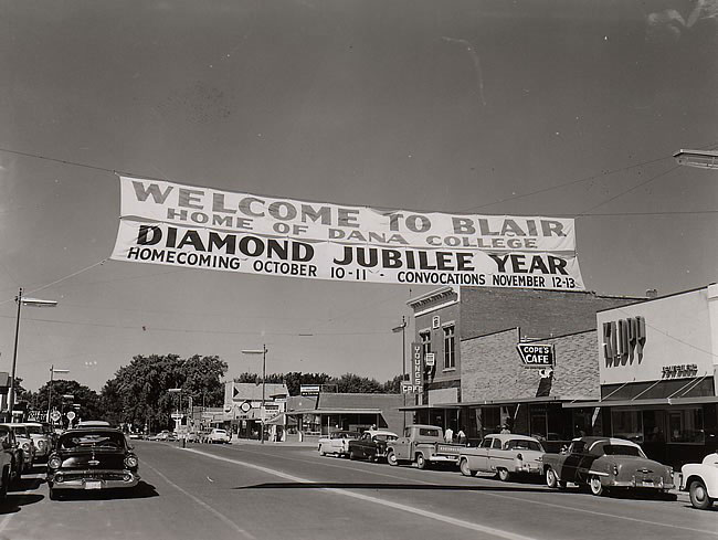
Most people in Washington County know that Highway 30 and the Lincoln Highway are one and the same. But not too many local people realize that there is a Lincoln Highway Association (LHA).
Even though the original Lincoln Highway, turned south at Missouri Valley and went to Omaha, crossed the river and ran through Elkhorn on to Fremont, the official Lincoln Highway went through Washington County after the Blair Bridge was constructed.
The Lincoln Highway Association will hold its ninth annual national conference June 13-16 in Grand Island. The Association points out that the Lincoln Highway was a significant factor in the historic and economic development of the twelve states through which it passed.
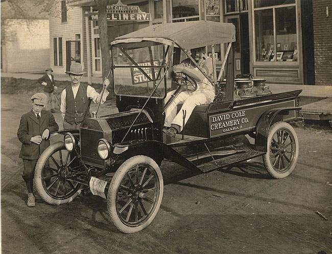
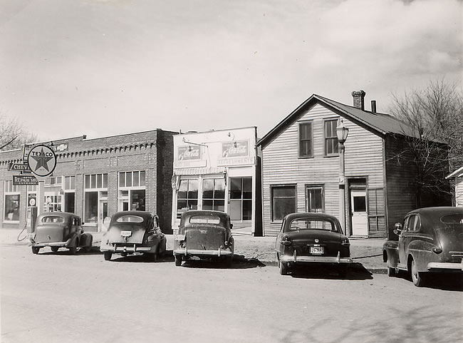
The Lincoln Highway played a major role in the economic development of Nebraska along the corridor through which it passed from Omaha westward to Kimball. When the Blair Bridge was constructed some enterprising Blair business people made a “midnight” route change that stuck.
The hand-me-down story goes that Lyle Guyer, LeRoy Snyder, Emmett Rounds, Reed O’Hanlon and others were disappointed that the traffic was not coming across the then-new Blair Bridge. The reason for the lack of traffic was that the Lincoln Highway signs turned all the traffic south at Missouri Valley instead of directing the motorists west to try the new Blair Bridge.
The “midnight” crew took their shovels and dug up the markers and re-planted them on the highway going straight west from Mo. Valley. The change in marker locations worked and the traffic started coming across the Blair Bridge and through Washington County.
The route in Blair ran along what is now Jackson Street, on the south side of the cemetery, turned south on Tenth street and then west on Nebraska Street and eventually joined the present Highway 30 to Kennard, Arlington and Fremont.
The highway route was established in 1913, extended from Times Square in New York City and countinued through New Jersey, Pennsylvania, Ohio, Indiana, Illinois, Iowa, Nebraska, Wyoming, Utah, Nevada and California. In its trek across these states it passed through hundred of cities and town, including the conference city of Grand Island.
Those Lincoln Highway markers were made of concrete and extended about four feet above ground level with a special emblem implanted in the concrete. Up until a few years ago there were two of those markers still in the ground. One was at the corner of Jackson and Tenth street in Blair and the other was in Arlington. Both markers have disappeared. The Washington County Museum would like to find and put on display one of the markers as a permanent reminder of the Lincoln Highway and its part in developing the county.
Some research has revealed that the Lincoln Highway was America’s first transcontinental road. In the early part of this century there were few connecting roads between cities and towns. For the most part, rural roads radiated from rail centers and did not form any sort of connecting road system. In 1912, a visionary businessman named Carl Fisher proposed a transcontinental road. Fisher had, just a year earlier, built the now legendary Indianapolis Speedway. Henry Joy, President of the Packard Motor Company, joined Fisher in his highway venture. Together, these men and their supporters, having organized themselves as the LHA, performed the seemingly impossible. By September, 1913, they had identified and marked the route of the Lincoln Highway across the United States, Within a decade and a half, the Lincoln Highway became the country’s first coast to coast road that was nearly all paved.
By 1925, the Lincoln Highway had become one of 459 named highways in the United States, each with its own distinctive colorful emblem. Confusion reigned with all these names and logos. Road identification had become such a problem that the federal government decreed that, henceforth highways would be numbered and not named.
The Lincoln Highway did not die when it lost its name to a nondescript numbering system. Many local residents continued to call the route the Lincoln Highway. In 1992, fans of the Lincoln Highway got together and resurrected the dormant LHA. The new LHA now promotes the route of the Lincoln Highway with historic research, numerous publications, tours and support of tourism activities along the route. Many members of the LHA have marked the route with replicas of the original 1913 Lincoln Highway emblems. One of the replicas is in the Blair City Council chambers.
In the past few years the Blair Chamber of Commerce put up pennants stating the route of the Lincoln Highway through Blair. A similar organization in Elkhorn, Nebraska, protested that the original route went through their community and Blair should not make a claim to the Lincoln Highway. The controversy still festers but the Blair banners were taken down.
If anyone would like to attend the LHA Convention, starting June 13 in Grand Island, they can get more information by contacting: Bob Stubblefield, 7300 Willow Road., Shelton, Nebraska 68876 or phone him at 308-647-6554.
Kenneth Rhoades is co-publisher of The Pilot-Tribune
This and That: There it is
By Kenneth Rhoades
Recently this column was devoted to the origin of the Lincoln Highway that ran through the center of Washington County. The highway is now known as Highway 30. In the article it mentioned that there were concrete markers that were placed along the highway for motorists to follow.
The posts were set in the ground and extended up several feet. The markers had the Lincoln Highway emblem imbedded in them. Up until a few years ago there were still two markers in Washington County, one in Blair and one in Arlington. Both markers disappeared and the Washington County Museum would like to have one of the markers as a permanent display in recognition of that first highway that went from one coast to the other. After the article was printed I received a phone call from a man that knew where one of the markers was located. He said the one in Arlington was moved from the old railroad property, that bordered the Lincoln Highway, and was moved two blocks north to the Arlington Library. If you would like to see the marker then take a drive past the Arlington Auditorium which houses the Arlington Library.
Adjust the text size


Featured Pictures
Archive Links
BHPA Links
Blair Historic Preservation Alliance | P.O. Box 94 | Blair, Nebraska 68008 | contact@blairhistory.com